
Aerial Imagery Services

Orthomosaics
This type of aerial imagery is produced by stitching together a collection of very high-resolution images seamlessly over an expansive site area.
Through photogrammtery, the resulting master-image is georeferenced to real-world coordinates. Some typical use cases for this include:
-
Background imagery for conceptual exhibits and engineering plans
-
Taking measurements of features inaccessible by foot
-
Construction progress tracking
Orthomosaic imagery produced from Altiun drones is typically an order of magnitude higher in resolution than satellite imagery (e.g. 1 to 2 inches versus 1 to 2 feet), providing an incredible level of detail.
Promotional Content
An aerial showcase is an excellent way to leave a lasting impression with your clients and promote your business. At Altiun, our skilled pilots expertly capture your site with breathtaking perspectives in 4K video and still images up to 50MP resolution. Raw captures are further enhanced in creative studios to produce stunning visual content.
Showcase Package:
-
(32+) Aerial images at various angles/altitudes/distances
-
(x2) Top-down Images, 1 high altitude, 1 medium altitude
-
(x1) Panoramic
-
(x1) Cinematic reel up to 1 minute duration, comprised of 6-10 second clips

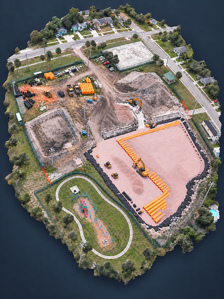
3D Exhibits
The next best thing to being on site, is being there virtually. Altiun is able to produce highly detailed 3D digital twins of your site with two different methods: traditional photogrammetry, or Gaussian splatting. Which method Altiun applies will depend on the ultimate use case for your 3D model. Here are some example use cases:
Contractors
Preserve an accurate account of pre- and post-development conditions.
Land Developers
Provide cinematic virtual tours.
Architects
View any location within a site from any angle.
Engineers
Extract accurate dimensions of site features.